Old Ordnance Survey Maps of Surrey

  • These detailed maps normally cover an area of about one and a half miles by one mile. Each map includes an introduction.
  • They are available through our On-line Mapshop

  • Here are the details of maps for Weybridge East:

  • Surrey Sheet 11.12 Weybridge (East) 1912 - published 2024; intro by Tony Painter. ISBN.978-1-78721-732-4

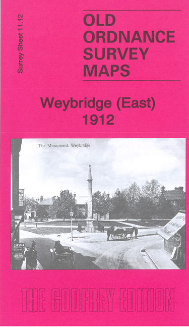
    This map covers the eastern part of Weybridge. The map is double-sided, to include Weybridge station

    Features include Portmore Park, Monument Green, Monument, Oatlands Palace Gardens, Oaskfield, The Green, numerous villas in grounds, Finnart House, Oatlands Lodge, Weybridge Park, Oatlands Park Hotel, Oatlands Park, St Mary's church, Metropolitan Convalescent Institution, Marrowells, etc

    On the reverse is a specially written introduction to the history of the area.

    The map links up with sheet 11.11 Weybridge West & Addlestone to the west.


  • Follow this link for a complete list of our Surrey maps, here for Croydon, or here for the London Boroughs.
  • You can order maps direct from our On-line Mapshop. For other information and Prices, see Index Page.
  • Most maps in the Godfrey Edition are taken from the 25 inch to the mile map and reduced to about 15 inches to the mile.
    The Godfrey Edition / sales@alangodfreymaps.co.uk / 17 April 2024