Old Ordnance Survey Maps of Somerset


This page summarises the local government organisation of Somerset since 1889.

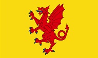
  • Somerset County Council was formed in 1889, and in 1894 a network of boroughs, urban district and rural district councils was formed across the county.
  • Somerset had five Municipal Boroughs dating back to 1836 (or earlier): Bath, Bridgwater, Chard, Glastonbury, and Wells. Yeovil became a Municipal Borough in 1854, Taunton in 1885, and Weston-super-Mare in 1937. Bath became a County Borough in 1889.
  • From 1894 there were also 13 Urban Districts: Burnham (Burnham-on-Sea from 1917), Clevedon, Crewkerne, Frome, Midsomer Norton, Minehead, Portishead, Radstock, Shepton Mallet, Street, Wellington, Weston-super-Mare, and Wiveliscombe UDCs. They were joined by Highbridge UDC (1896), Ilminster UDC (1899), Watchet UDC (1902) and Keynsham UDC (1938). Urban Districts had similar powers to Municipal Boroughs but lacked the right to elect mayors or aldermen. Bath and Wells have city status.
  • In 1933 Midsomer Norton and Radstock UDCs were amalgamated as Norton-Radstock UDC, and Wiveliscombe UDC was absorbed by Wellington RDC. Weston-super-Mare UDC became a borough in 1937.
  • From 1894 there were also 18 Rural District Councils covering the areas outside the major towns, but these had less powers. Initially most RDCs were based on the Unions, met at the Workhouse, and had the Guardians serving as councillors. These were: Axbridge, Bath, Bridgwater, Chard, Clutton, Dulverton, Frome, Keynsham, Langport, Long Ashton, Poyntington, Shepton Mallet, Taunton, Wellington, Williton, and Wincanton Rural Districts. However, Poyntington RDC was abolished in 1895 and absorbed by Sherborne RDC in Dorset. Bath and Keynsham RDCs were merged as Bathavon RDC in 1933.
  • In 1974 major reorganisation saw Somerset adopt a two-tier local government structure, with a County Council and 5 District Councils, while the northern part of the county was removed and became part of the new County of Avon. The Somerset Districts were: Mendip, Sedgemoor, South Somerset, Taunton, and West Somerset. Taunton has borough status.
  • The northern part of the county was divided into 3 Districts, which became part of the County Avon. These were: the City of Bath; Wansdyke District (which absorbed Keynsham UDC, Norton-Radstock UDC, Bathavon RDC and part of Clutton RDC); Woodspring District (which absorbed Weston-super-Mare Municipal Borough, Clevedon UDC, Portishead UDC, Long Ashton RDC, and part of Axbridge RDC).
  • In 1996 the County of Avon was abolished. Woodspring District was renamed North Somerset and became a unitary authority. the City of Bath and Wansdyke District were amalgamated and became a unitary authority called Bath & North East Somerset.

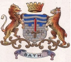
    For a list of Somerset maps go to the Somerset page. For a full list of English maps, return to the England page

    You can order maps direct from our On-line Mapshop.


    Minor changes are not listed here, but please advise us of any significant errors or omissions.
    Alan Godfrey Maps, Prospect Business Park, Leadgate, Consett, DH8 7PW. Tel 01207 583388
    The Godfrey Edition / sales@alangodfreymaps.co.uk / 22 October 2016