
 Here are the details of maps for Wincanton & Templecombe:

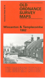
This detailed map is double-sided. The main map covers most of the small town of Wincanton, with coverage extending from St Peter & St Paul's church northward to the small village of Charlton Musgrove, and eastward to Bayford. Features include the Workhouse, Church Street, High Street, Mill Street, North Street, Shadwell, Coneygore, Windmill Hill, Verrington Lodge, Balsam House, Bayford Lodge, Charlton House, Ireson House, St Stephen's church (Charlton Musgrove). Note that the station is not included.
On the reverse we include a good section of Somerset sheet 75.16 covering the village of Templecombe, with its complicated junction between the LSWR and Somerset & Dorset railways, well shown here with track layout. Features here include the station, St Mary's church, Temple Combe, Abbas Combe, Royal Hotel.