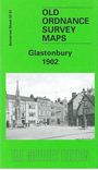
Somerset Sheet 52.07 Glastonbury 1902 - published 1991, rev 2003; introduction by Alan Godfrey. ISBN.978-0-85054-468-8 
This detailed map provides good coverage of Glastonbury and the surrounding area. The map shows Edmund Hill to the north and stretches
south beyond Chalice Hill. Coverage stretches west to show the railway station and east to Tor Hill. Features include Glastonbury Abbey,
Armoury and Almhouses, Cattle Market and Leather Factory. Also features an extract from a directory on the reverse.
You might find this index map useful.
Follow this link for a list of our maps for Somerset or here for a general list for the South West.
You can order maps direct from our On-line Mapshop.
For other information and prices, and other areas, go to The Index Page.
Maps in the Godfrey Edition are taken from the 25 inch to the mile map and reduced to about 15 inches to the mile.
For a full list of maps for England, return to the England page.
Alan Godfrey Maps, Prospect Business Park, Leadgate, Consett, Co Durham, DH8 7PW / sales@alangodfreymaps.co.uk / 13 January 2018

 Here are the details of maps for Glastonbury: