We have published more than 1,900 maps in our series of Old Ordnance Survey Map reprints, including a group in Somerset. The maps are highly detailed. They are taken from the OS 1:2,500 (or 25 inch) maps and reduced to about 15 inches to the mile. Each covers an area of a mile and a half by a mile. They show streets with individual houses, tram tracks, railway tracks and even signals, factories, wharves and such details as fountains and water troughs. They will provide hours of fascination for historians and genealogists. The maps are neatly folded and each includes a specially written introduction to the area. Maps can be purchased on our On-line Mapshop where further information about titles is given. Or visit The Index Page for a full list to the series and details of Prices.
Here are the details of maps for Frome:
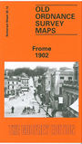
Frome was once a larger town than Bath but, like many Somerset towns, it went into decline in the early 19th century. One of its most interesting features is the Trinity area of working class housing, one of the finest such groups surviving from the 17th and 18th centuries. Our map covers the centre and the area to the NW, as far as Vallis Farm and Egford Bridges, along with a list of private residents.
Features include Broadway, Christchurch street, railway line, baths, Selwood Wagon Works, vinegar Works, Welshmill, Goulds Ground, Cottle's Oak, Kissing Batch, Metallic Art Works. We include an extract from Kelly's Directory of Somerset on the reverse.
You might find this index map useful.
Follow this link for a complete list of our Somerset Series maps.
You can order maps direct from our On-line Mapshop.
For other information and prices, and other areas, go to The Index Page.
Maps in the Godfrey Edition are taken from the 25 inch to the mile map and reduced to about 15 inches to the mile.
For a full list of maps for England, return to the England page.