We have published more than 2,000 maps in our series of Old Ordnance Survey Map reprints, including a group in Somerset. The maps are highly detailed. They are taken from the OS 1:2,500 (or 25 inch) maps and reduced to about 15 inches to the mile. Each covers an area of a mile and a half by a mile. They show streets with individual houses, tram tracks, railway tracks and even signals, factories, wharves and such details as fountains and water troughs. They will provide hours of fascination for historians and genealogists. The maps are neatly folded and each includes a specially written introduction to the area. Maps can be purchased on our On-line Mapshop where further information about titles is given. Or visit The Index Page for a full list to the series and details of Prices.
Here are the details of maps for Burnham-on-Sea:
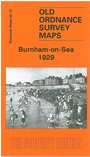
This detailed map covers the seaside town of Burnham, which added 'on-Sea' to its name in 1917. Most of the town is covered, from Sea View Road southward to Pillsmouth Farm, and inland to Rosewood Farm and Burnham Rhyne. Features include the Somerset & Dorset Railway with station, Burnham Brewery, pier, Convent, Court House, Manor Farm, St Andrew's church, Esplanade Pavilion, High Street, River Parrett, The Hall, Manor House, and the town centre shown in detail with individual houses neatly delineated. On the reverse we include a commercial directory of Burnham.
Follow this link for a complete list of our Somerset Series maps.
You can order maps direct from our On-line Mapshop. For other information and prices, and other areas, go to The Index Page.
Maps in the Godfrey Edition are taken from the 25 inch to the mile map and reduced to about 15 inches to the mile. For a full list of maps for England, return to the England page.
The Godfrey Edition / godfreyedition@btinternet.com / 15 May 2007