
Old Ordnance Survey Maps of Somerset
These detailed maps normally cover an area of about one and a half miles by one mile. Each map includes an introduction.
They are available through our On-line Mapshop
 Here are the details of maps for Axbridge:
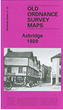
Somerset Sheet 17.16 Axbridge 1929 - published July 2006; introduction by Tony Painter. ISBN.978-1-84151-908-1 
This detailed map gives good coverage of the little town of Axbridge and the area to the north. Features
include Cheddar street, St John's Church, Poor Law Institution, St Michael's Home, railway line and station. We include
an early directory on the reverse, together with a 1920s railway timetable.
Follow this link for a list of our maps for Somerset or here for a general list for the South West.
You can order maps direct from our On-line Mapshop.
For other information and prices, and other areas, go to The Index Page.
Maps in the Godfrey Edition are taken from the 25 inch to the mile map and reduced to about 15 inches to the mile.
For a full list of maps for England, return to the England page.
Alan Godfrey Maps, Prospect Business Park, Leadgate, Consett, Co Durham, DH8 7PW / sales@alangodfreymaps.co.uk / 13 January 2018