We have published more than 2,000 maps in our series of Old Ordnance Survey Map reprints, including a group in Somerset. The maps are highly detailed. They are taken from the OS 1:2,500 (or 25 inch) maps and reduced to about 15 inches to the mile. Each covers an area of a mile and a half by a mile. They show streets with individual houses, tram tracks, railway tracks and even signals, factories, wharves and such details as fountains and water troughs. They will provide hours of fascination for historians and genealogists. The maps are neatly folded and each includes a specially written introduction to the area. Maps can be purchased on our On-line Mapshop where further information about titles is given. Or visit The Index Page for a full list to the series and details of Prices.
Here are the details of maps for Portishead (East):
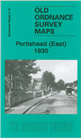
This detailed map is one of three being published for Portishead. It covers the eastern part of the town, with coverage stretching from the High Street eastward to Portbury House and Sheepway Gate Farm. Much of the map is rural but features include the GWR and Weston Clevedon & Portishead Railway, the latter with two stations; the Nail Factory opened by the Mustard Manufacturing Co, which specialised in horseshoe nails; Moor Farm, brick works, Middle Bridge, Severn Kraft Mills, New Town. On the reverse we include extracts from a 1902 directory plus a railway timetable for the Bristol-Portishead line.
The map links up with Somerset Sheet 2.05 Portishead North to the north and Sheet 2.09 Portishead West to the west.
Follow this link for a complete list of our Somerset Series maps.
You can order maps direct from our On-line Mapshop. For other information and prices, and other areas, go to The Index Page.
Maps in the Godfrey Edition are taken from the 25 inch to the mile map and reduced to about 15 inches to the mile. For a full list of maps for England, return to the England page.
The Godfrey Edition / godfreyedition@btinternet.com / 23 February 2007