Old Ordnance Survey Maps of Surrey

  • These detailed maps normally cover an area of about one and a half miles by one mile. Each map includes an introduction.
  • They are available through our On-line Mapshop

  • Here are the details of maps for Reigate:

  • Surrey Sheet 26.15 Reigate 1895 - published 2001; intro by Alan A Jackson. ISBN.978-1-84151-260-0

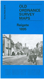
    This detailed map covers the centre of Reigate, and an area stretching eastward to Hatchlands Corner, and northward to Wray Common and Wray Park. Author Alan Jackson comments that the map "vividly portrays the contrast between its medieval street pattern (West Street, High Street, Bell Street) and its then new Victorian growth to the north and east". Features include Market Place, Castle Grounds, station, The Priory, St Mary Magdalene's church, Reigate Lodge, Great Doods, cemetery, Underhill Park. There is a directory of private inhabitants in 1899 on the reverse.


  • Follow this link for a complete list of our Surrey maps, here for Croydon, or here for the London Boroughs.
  • You can order maps direct from our On-line Mapshop. For other information and Prices, see Index Page.
  • Most maps in the Godfrey Edition are taken from the 25 inch to the mile map and reduced to about 15 inches to the mile.
    The Godfrey Edition / sales@alangodfreymaps.co.uk / 12 January 2018