We have published more than 1,900 maps in our series of Old Ordnance Survey Map reprints, including groups in Hampshire and Wiltshire. The maps are highly detailed. They are taken from the OS 1:2,500 (or 25 inch) maps and reduced to about 15 inches to the mile. Each covers an area of a mile and a half by a mile. They show streets with individual houses, tram tracks, railway tracks and even signals, factories, wharves and such details as fountains and water troughs. They will provide hours of fascination for historians and genealogists. The maps are neatly folded and each includes a specially written introduction to the area. Maps can be purchased on our On-line Mapshop where further information about titles is given. Or visit The Index Page for a full list to the series and details of Prices.
Here are the details of maps for Petersfield:
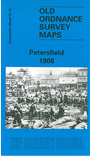
This detailed map covers the market town of Petersfield which, standing on both the road and, later, railway to Portsmouth, grew steadily with the fortunes of that naval port. Our map covers the town centre and extends NBE to Ram's Hill and Broadband House. Features include The Square, High Street, Dragon Street, Chapel Street, Lavant Street, The Causeway, brewery, Herne House, Heath Pond, Workhouse, Churchers College, station, Borough Farm, Buckmoor Farm, Berelands, Rushes Farm, St Peter's church, Tilmore Brook. On the reverse we include a good directory of Petersfield in 1903.
Follow this link for a complete list of our Hampshire Series maps.
You might find this index map useful.
You can order maps direct from our On-line Mapshop. For other information and prices, and other areas, go to The Index Page.
Maps in the Godfrey Edition are taken from the 25 inch to the mile map and reduced to about 15 inches to the mile. For a full list of maps for the South West, return to the South West page.
The Godfrey Edition / godfreyedition@btinternet.com / 11 February 2006