 Here are the details of maps for Cardigan & St Dogmells

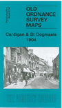
This detailed map is split between Cardiganshire and Pembrokeshire (we have used the Pembrokeshire series map as the sheetlines are somewhat kinder). The town of Cardigan is in the top right corner and features here include the town centre, including High Street, Priory Street, part of Pendre, Cardigan Bridge, castle remains, Custom House, malthouses, Bridgend, Station Road (but actual station is just off the map). The map then extends westward to St Dogmells (or Dogmaels, or Llandudoch) in Pembrokeshire; features here include St Thomas church, woollen factory, High Street, Abbey remains, and coverage extends south to Blaenywaun Baptist Chapel. On the reverse we include the 1906 directory entry for St Dogmells and the list of private residents for Cardigan.
Maps in the Godfrey Edition are taken from the 25 inch to the mile map and reduced to about 15 inches to the mile. For a full list of maps for Wales, return to the Wales page
The Godfrey Edition / sales@alangodfreymaps.co.uk / 4th December 2016