Old Ordnance Survey One-Inch Maps


These maps are taken from the famous OS "Inch to the Mile" Maps. Though obviously far less detailed than the large scale maps for which we are perhaps better known, they provide an invaluable overview of a wider area, typically 18 miles across by 12 miles down. For transport historians they are invaluable for showing old railways, while all historians need them for their close depiction of topography, including parish boundaries. These maps also mean that we can offer historical coverage for small villages where a large scale map would not be commercially viable. We intend to publish the whole of England and Wales in this series. Over 200 titles are now available and we aim to publish three new titles each month. The maps include historical notes and all (except the double-sided Tyneside title) also include a large scale map of a small town or village in the area.

The maps are neatly folded and each includes a specially written introduction to the area. Maps can be purchased on our On-line Mapshop where further information about titles is given. Visit the One Inch Page for a full list of Inch to the Mile Maps, or The Index Page for a full list to the series and details of Prices.

Here is information about Sheets 357 & 360:

  • One Inch Sheet 357/360 Isles of Scilly 1896 - published 2008; introduction by Tom Greeves

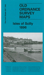
    This Inch to the Mile map was issued by the OS as a composite map covering the whole of the Isles of Scilly. It is a useful addition to the series, especially for those looking for complete coverage of Cornwall or, indeed, the country, though we feel the original cartography makes it something of a curiosity. On the reverse we include a large extract of Cornwall sheet 87.02, which covers much of Hugh Town in detail, coverage stretching from Garrison Hill eastward to Tolman Point and Old Town ; features include Buzza Hill, Trinity Houses, Custom House, lifeboat house, old pier etc.


    It is not possible to list the many hamlets, farmsteads and other topographical features shown on these maps. However, you may find it useful if we list the towns and principal villages or church parishes that are included on this map. Links are given for those for which detailed large-scale maps are also available.

  • Cornwall: The whole of the Isles of Scilly is covered, including the following islands: Bryher, Tresco, Samson, St Helens, Tean, St Martins, Eastern Isles, St Mary's, St Agnes, Annet, Melledgan, Western Rocks.

    For a full list of Inch to the Mile maps go to the One Inch Page; or for larger scale maps go to the South West page.

    You can order maps direct from our On-line Mapshop. For other information and prices, and other areas, go to The Index Page.


    The Godfrey Edition / godfreyedition@btinternet.com / 26 Sept 2008