
 Here is information about Sheet 353:
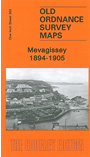
With this map we give you two maps for the price of one. One side has Inch to the Mile Sheet 353, which covers the area from Mevagissey westward to Tregoney, southward to Veryan Bay and Dodman Point.
The other side has a large scale map of Mevagissey, sheet 59.12, covering the town in detail. Features here include Stuckumb Point, Harbour, The Pool, St Issi's church, Treleaven, town centre with all houses neatly delineated.
It is not possible to list the many hamlets, farmsteads and other topographical features shown on these maps. However, you may find it useful if we list the towns and principal villages or church parishes that are included on this map. Links are given for those for which detailed large-scale maps are also available.
Index maps are available showing the areas covered by the Inch to the Mile maps. Go to This page
You can order maps direct from our On-line Mapshop. For a full list of Inch to the Mile maps go to the Inch to the Mile page, where you will also find details of prices. For information on the rest of the series, go to The Index Page.