
 Here is information about Sheet 315:
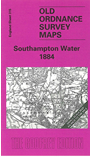
This early Inch to the Mile map covers an area of Hampshire centred on Southampton. There is a tiny portion of Wiltshire in the NW corner. The River Test runs through the map, leading to Southampton Water. Part of the New Forest is in the SW quarter. Coverage stretches from Mogshade Hill and Landford eastward to Botley and Swanwick, and from Melchet Park and Romsey southward to Beaulieu Heath and Hamble Spit. There is a fine contrast between Southampton with its expanding docks and populated hinterland and the leafy remoteness of the New Forest, nicely portrayed by the OS on this map. Other features include the vast Netley Hospital, with its railway branch; and close observers of the parish boundaries on these maps will note the extra parochial Melchet Park. On the reverse we include a map of the village of Sarisbury.
It is not possible to list the many hamlets, farmsteads and other topographical features shown on these maps. However, you may find it useful if we list the towns and principal villages or church parishes that are included on this map. Links are given for those for which detailed large-scale maps are also available. (Please note that we hope to puiblish some detailed maps for Southampton later in 2006.)
Index maps are available showing the areas covered by the Inch to the Mile maps. Go to This page
You can order maps direct from our On-line Mapshop. For a full list of Inch to the Mile maps go to the Inch to the Mile page, where you will also find details of prices. For information on the rest of the series, go to The Index Page.