
Old Ordnance Survey Inch to the Mile Maps
These maps normally cover an area of about 18 miles by 12 miles and are especially good at showing railways, roads and canals, and at giving
a broad view of a wider area. Each includes an introduction and a more detailed map of a small town or village.
They are available through our On-line Mapshop
 Here is information about Sheet 284:
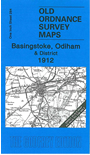
One Inch Sheet 284 Basingstoke, Odiham & District 1912 - published 2006; intro by Tony Painter. ISBN.978-1-84151-889-3
This Inch to the Mile map covers the area of north Hampshire around Basingstoke, also including the small town of Odiham. Coverage stretches from
Deane and Hannington eastward to Fleet, and from Tadley and Bramshill southward to Froyle and Lasham. The Basingstoke Canal and a good stretch of the Basingstoke & Alton Light Railway will interest transport historians, while
those more concerned with literature will finmd the home villages of Jane Austen at Steventon and Charles Kingsley at Eversley. On the reverse we include a detailed map of the village of Sherborne St John, complete with directory.
It is not possible to list the many hamlets, farmsteads and other topographical features shown on these maps. However, you may find it useful if we list the towns and
principal villages or parishes that are included on this map:
Hampshire:Andwell, Ashe, Basing, Basingstoke, Baughurst, Bentley, Bramley, Bramshill, Church Oakley, Cliddesden, Coldrey, Crondall, Crookham, Deane, Dogmersfield, Dummer with Kempshot,
Ellisfield, Elvetham, Ewhurst, Farleigh Wallop, Fleet, Froyle, Greywell, Hannington, Hartley Wespall, Hartley Wintney, Heckfield, Herriard, Lasham, Long Sutton,
Maplederwell, Mattingley, Monk Sherborne, Nateley Soures, Newnham, North Waltham, Nutley, Odiham, Pamber, Popham, Rotherwick, Sherborne St John, Sherfield upon Loddon, South Warnborough, Steventon,
Stratfield Turgis, Tadley, Tunworth, Up Nateley, Upton Grey, Weston Corbett, Weston Patrick, Winchfield, Winslade, Wolverton, Woodmancott, Wootton St Lawrence, Worting.
Index maps are available showing the areas covered by the Inch to the Mile maps. Go to This page
You can order maps direct from our On-line Mapshop. For a full list of Inch to the Mile maps go to the Inch to the Mile page,
where you will also find details of prices. For information on the rest of the series, go to The Index Page.
Alan Godfrey Maps, Prospect Business Park, Leadgate, Consett, Co Durham, DH8 7PW / sales@alangodfreymaps.co.uk / 16 April 2011