
Old Ordnance Survey Inch to the Mile Maps
These maps normally cover an area of about 18 miles by 12 miles and are especially good at showing railways, roads and canals, and at giving
a broad view of a wider area. Each includes an introduction and a more detailed map of a small town or village.
They are available through our On-line Mapshop
 Here is information about Sheet 282:
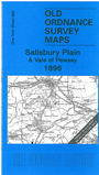
One Inch Sheet 282 Salisbury Plain & Vale of Pewsey 1896 - published 2008; intro by Tony Painter. ISBN.978-1-84784-198-8
This Inch to the Mile map covers the area from Devizes southward to Bulford, and eastward to Pewsey. Much of Salisbury Plain is included and on the reverse we include a detailed map of the 'lost village'
of Imber, commandeered for military use in 1943, with the villagers given 47 days to leave - never to return.
It is not possible to list the many hamlets, farmsteads and other topographical features shown on these maps. However, you may find it useful if we list the towns and
principal villages or parishes that are included on this map:
Wiltshire: All Cannings, Beechingstoke, Bulford, Burbage, Charlton, Chirton, Devizes, Durrington, Earl Stoke, East Coulston,
Easterton, Easton Royal, Enford, Etchilhampton, Everley, Figheldean, Fittleton, Great Cheverell, Imber, Little Cheverell, Maddington, Manningford Abbots, Manningford Bruce,
Marden, Market Lavington, Marston, Milston, Milton Lilbourne, Netheravon, North Newnton, Orcheston St George, Orcheston St Mary, Patney, Pewsey, Potterne, Poulshot,
Rollestone, Rushall, Shipton Bellinger, Shrewton, Stert, Tilshead, Upavon, Urchfont, West Lavington, Wilcot, Wilsford, Woodborough, Worton.
Index maps are available showing the areas covered by the Inch to the Mile maps. Go to This page
You can order maps direct from our On-line Mapshop. For a full list of Inch to the Mile maps go to the Inch to the Mile page,
where you will also find details of prices. For information on the rest of the series, go to The Index Page.
Alan Godfrey Maps, Prospect Business Park, Leadgate, Consett, Co Durham, DH8 7PW / sales@alangodfreymaps.co.uk / 16 April 2011