
Old Ordnance Survey Inch to the Mile Maps
These maps normally cover an area of about 18 miles by 12 miles and are especially good at showing railways, roads and canals, and at giving
a broad view of a wider area. Each includes an introduction and a more detailed map of a small town or village.
They are available through our On-line Mapshop
 Here is information about Sheet 272:
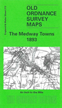
One Inch Sheet 272 The Medway Towns 1893 - published 2003; intro by Tony Painter. ISBN.978-1-84151-548-9
This map covers the area of north Kent from the Medway towns eastward to Sittingbourne, and northward to Sheerness and the western half of the Isle of
Sheppey. It covers the Medway from Sheerness up to Snodland. The towns on the map are Rochester, Chatham, Sheerness, Sittingbourne and Milton. Transport
historians will be interested in the Hundred of Hoo line to Port Victoria. On the reverse is a detailed map of Minster.
It is not possible to list the many hamlets, farmsteads and other topographical features shown on these maps. However, you may find it useful if we list the towns and
principal villages or church parishes that are included on this map:
Kent: Allhallows, Bapchild, Borden, Bredgar, Bredhurst, Brompton, Burham, Chatham, Cliffe, Cooling, Cuxton, East Tilbury,
Frindsbury, Gillingham, Grain, Hartlip, High Halstow, Higham or Church Street, Hoo, Iwade, Linsted, Lower Halling, Lower Halstow, Milton, Minster, Murston, Newington,
Queenborough, Rainham, Rochester, Rodmersham, Sheerness, Stone, Sittingbourne, Snodland, St Mary Hoo, Stockbury, Stoke, Strood, Teynham, Tonge, Tunstall, Upchurch,
Wouldham.
Index maps are available showing the areas covered by the Inch to the Mile maps. Go to This page
You can order maps direct from our On-line Mapshop. For a full list of Inch to the Mile maps go to the Inch to the Mile page,
where you will also find details of prices. For information on the rest of the series, go to The Index Page.
Alan Godfrey Maps, Prospect Business Park, Leadgate, Consett, Co Durham, DH8 7PW / sales@alangodfreymaps.co.uk / 16 April 2011