Old Ordnance Survey One-Inch Maps


These maps are taken from the famous OS "Inch to the Mile" Maps. Though obviously far less detailed than the large scale maps for which we are perhaps better known, they provide an invaluable overview of a wider area, typically 18 miles across by 12 miles down. For transport historians they are invaluable for showing old railways, while all historians need them for their close depiction of topography, including parish boundaries. These maps also mean that we can offer historical coverage for small villages where a large scale map would not be commercially viable. We intend to publish the whole of England and Wales in this series. Almost 200 titles are now available and we aim to publish three new titles each month. The maps include historical notes and all (except the double-sided Tyneside title) also include a large scale map of a small town or village in the area.

The maps are neatly folded and each includes a specially written introduction to the area. Maps can be purchased on our On-line Mapshop where further information about titles is given. Visit the One Inch Page for a full list of Inch to the Mile Maps, or The Index Page for a full list to the series and details of Prices.

Here is information about Sheet 265:

  • One Inch Sheet 265 Bath, Marshfield & the Vale of Avon - published 2006; introduction by Tony Painter

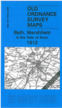
    This Inch to the Mile map covers the area around and to the north and east of Bath, and is fairly evenly split between Gloucestershire, Somerset and Wiltshire. Coverage stretches from Oldland and Mangotsfield eastward to Chippenham, and from Old Sodbury southward to Melksham. Apart from the historic city of Bath, the celebrated villages of Lacock and Castle Combe are also included, and the smaller towns of Corsham, Chippenham and Melksham. On the reverse is a detailed map of the little town of Marshfield. For transport historians, the map includes sections of the MR Bath-Westerliegh line, Box tunnel and the GWR main line, plus the industrial tramways around Corsham.


    It is not possible to list the many hamlets, farmsteads and other topographical features shown on these maps. However, you may find it useful if we list the towns and principal villages or parishes that are included on this map:

  • Gloucestershire: Acton Turville, Bitton, Coalpit Heath, Cold Ashton, Dodington, Doynton, Dyrham & Hinton, Frampton Cotterell, Mangotsfield, Marshfield, Old Sodbury, Oldland, Pucklechurch, Siston, Thormarton, Wapley & Codrington, West Littleton, Westerleigh.
  • Somerset: Bath, Bathampton, Batheaston, Bathford, Burnett, Charlcombe, Claverton, Corston, English Combe, Kelston, Langridge, Newton St Loe, North Stoke, Saltford, St Catherine, Stanton Prior, Swainswick, Twerton, Weston, Woolley
  • Wiltshire: Atworth, Biddestone, Box, Broughton Gifford, Castle Combe, Chippenham, Colerne, Corsham, Draycot Cerne, Grittleton, Hardenhuish, Kington Langley, Kington St Michael, Lacock, Leigh Delamere, Littleton Drew, Melksham, Monkton Farleigh, Nettleton, North Wraxall, Slaughterford, South Wraxall, Stanton St Quintin, Sutton Benger, West Kington, Yatton Keynell.

    For a full list of maps for the area go to the South West page.

    You can order maps direct from our On-line Mapshop. For other information and prices, and other areas, go to The Index Page.


    The Godfrey Edition / godfreyedition@btinternet.com / 11 May 2006