
Old Ordnance Survey Inch to the Mile Maps
These maps normally cover an area of about 18 miles by 12 miles and are especially good at showing railways, roads and canals, and at giving
a broad view of a wider area. Each includes an introduction and a more detailed map of a small town or village.
They are available through our On-line Mapshop
 Here is information about Sheet 254:
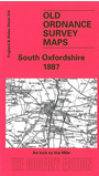
One Inch Sheet 254 South Oxfordshire 1887 - published 2003; intro by Tony Painter. ISBN.978-1-84151-541-0
This Inch to the Mile map covers the south Oxfordshire area around Watlington, Wallingford and Henley. To the west is part of Berkshire, to the east Buckinghamshire. Coverage stretches from Blewbury eastward to
Medmenham, and from March Baldon southward to Rotherfield Peppard. Tony Painter writes that the map "neatly contrasts the enduring aspects of the Thames Valley and its historic riverside towns with the majestic sweep of the southern
Chilterns with their ancient traditions, classic woodland scenery and sprinkling of spring line villages linked by prehistoric paths". On the reverse we include an extract from Oxfordshire Sheet 46.13 showing part of Dorchester in detail.
It is not possible to list the many hamlets, farmsteads and other topographical features shown on these maps. However, you may find it useful if we list the towns and
principal villages or church parishes that are included on this map. Links are given for those for which detailed large-scale maps are also available.
Berkshire: Aston Tirrold, Blewbury, Brightwell, Cholsey, Little Wittenham, Long Wittenham, Moulsford, North Moreton, Radley,
Remenham, Sotwell, South Moreton, Wallingford.
Buckinghamshire: Fawley, Fingest, Hambleden, Ibstone, Medmenham, Radnage, Turville.
Oxfordshire: Adwell, Aston Rowant, Benson, Berrick Salome, Brightwell Baldwin, Britwell Salome, Burcot, Chalgrove, Checkendon, Chislehampton, Clifton Hampden, Crowmarsh Gifford, Crowell, Cuxham,
Dorchester on Thames, Drayton, Easington, Ewelme, Harpsden, Henley on Thames, Ipsden, Lewknor, March Baldon, Mongewell, Nettlebed, Newington, Newnham Murren,
North Stoke, Nuffield, Nuneham Courtenay, Pyrton, Rotherfield Greys, Rotherfield Peppard, Shirburn, South Stoke, South Weston, Stadhampton, Stoke Talmage, Stokenchurch, Swyncombe, Warborough, Warpsgrove,
Watlington, Whatfield.
Index maps are available showing the areas covered by the Inch to the Mile maps. Go to This page
You can order maps direct from our On-line Mapshop. For a full list of Inch to the Mile maps go to the Inch to the Mile page,
where you will also find details of prices. For information on the rest of the series, go to The Index Page.
Alan Godfrey Maps, Prospect Business Park, Leadgate, Consett, Co Durham, DH8 7PW / sales@alangodfreymaps.co.uk / 16 April 2011