
Old Ordnance Survey Inch to the Mile Maps
These maps normally cover an area of about 18 miles by 12 miles and are especially good at showing railways, roads and canals, and at giving
a broad view of a wider area. Each includes an introduction and a more detailed map of a small town or village.
They are available through our On-line Mapshop
 Here is information about Sheet 240:
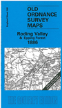
One Inch Sheet 240 Roding Valley & Epping Forest 1886 - published 2000; intro by John Marriage. ISBN.978-1-84151-174-0
This map covers the area of west Essex from Epping eastward to Margaretting and northward to Hatfield Broad Oak; the River Roding runs through the map and numerous
villages are shown either side of it. In the NW corner is a portion of Hertfordshire. On the reverse is a detailed map of Ingatestone, together with a directory.
It is not possible to list the many hamlets, farmsteads and other topographical features shown on these maps. However, you may find it useful if we list the towns and
principal villages or church parishes that are included on this map. A link is provided where we also publish a more detailed large scale map.
Essex: Abbess Roding, Aythorpe Roding, Beauchamp Roding, Berners Roding, Blackmore, Bobbingworth, Chignal Smealy, Chignal St James, Chipping Ongar
Epping, Fryerning, Fyfield, Good Easter, Great Canfield, Great Farndon, Greensted, Harlow, Hatfield Broad Oak, High Easter, High Laver, High Ongar, High Roding,
Ingatestone, Latton, Leaden Roding, Little Hallingbury, Little Laver, Little Parndon, Magdalen Laver, Margaret Roding, Margaretting, Mashbury, Moreton, Nazeing, North Weald Bassett, Roxwell, Sheering,
Shellow Bowells, Stanford Rivers, Stondon Massey, White Roding, Willingale Doe, Willingale Spain, Writtle.
Hertfordshire: Eastwick, Hunsdon, Roydon, Sawbridgeworth, Widford
Index maps are available showing the areas covered by the Inch to the Mile maps. Go to This page
You can order maps direct from our On-line Mapshop. For a full list of Inch to the Mile maps go to the Inch to the Mile page,
where you will also find details of prices. For information on the rest of the series, go to The Index Page.
Alan Godfrey Maps, Prospect Business Park, Leadgate, Consett, Co Durham, DH8 7PW / sales@alangodfreymaps.co.uk / 16 April 2011