
Old Ordnance Survey Inch to the Mile Maps
These maps normally cover an area of about 18 miles by 12 miles and are especially good at showing railways, roads and canals, and at giving
a broad view of a wider area. Each includes an introduction and a more detailed map of a small town or village.
They are available through our On-line Mapshop
 Here is information about Sheet 218:
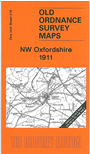
One Inch Sheet 218 NW Oxfordshire 1911 - published 2006; intro by Barrie Trinder. ISBN.978-1-84151-898-5
This map covers the area of Oxfordshire around Chipping Norton, with small portions of other counties at the fringe. Coverage
stretches from Adlestrop eastward to Aynho, and from Bodicote southward to Kirtlington Park. Features include the Banbury & Cheltenham Direct railway, and several major estates: Weston Park,
Middleton Park, Heythrop Park, Aynho Park.
It is not possible to list the many hamlets, farmsteads and other topographical features shown on these maps. However, you may find it useful if we list the towns and
principal villages or church parishes that are included on this map:
Gloucestershire: Adlestrop, Bledington, Great Wolford.
Northamptonshire: Aynho, King's Sutton, Newbottle.
Oxfordshire: Barford St John, Barford St Michael, Bloxham, Bodicote, Broughton, Chadlington, Chastleton, Chipping Norton, Churchill, Cornwell, Deddington, Duns Tew, East Adderbury,
Enstone, Fritwell, Glympton, Great Rollright, Great Tew, Heythrop, Hook Norton, Kiddington with Asterleigh, Kingham, Kirtlington, Little Rollright, Little Tew, Lower Heyford, Lyneham, Middle Aston,
Milcombe, Milton, Nether Worton, North Aston, Over Norton, Over Worton, Rousham, Salford, Sandford St Martin, Sarsden, Sibford Ferris, Sibford Gower, Somerton, Souldern, South Newington,
Spelsbury, Steeple Aston, Steeple Barton, Swalcliffe, Swerford, Tackley, Tadmarton, West Adderbury, Westcot Barton, Wigginton, Wootton.
Warwickshire: Barton on the Heath, Burmington, Cherinton, Great Wolford, Little Wolford, Long Compton, Stourton, Sutton under Brailes, Whichford.
Worcestershire: Daylesford, Tidmington.
Index maps are available showing the areas covered by the Inch to the Mile maps. Go to This page
You can order maps direct from our On-line Mapshop. For a full list of Inch to the Mile maps go to the Inch to the Mile page,
where you will also find details of prices. For information on the rest of the series, go to The Index Page.
Alan Godfrey Maps, Prospect Business Park, Leadgate, Consett, Co Durham, DH8 7PW / sales@alangodfreymaps.co.uk / 16 April 2011