Old Ordnance Survey One-Inch Maps


These maps are taken from the famous OS "Inch to the Mile" Maps. Though obviously far less detailed than the large scale maps for which we are perhaps better known, they provide an invaluable overview of a wider area, typically 18 miles across by 12 miles down. For transport historians they are invaluable for showing old railways, while all historians need them for their close depiction of topography, including parish boundaries. These maps also mean that we can offer historical coverage for small villages where a large scale map would not be commercially viable. We intend to publish the whole of England and Wales in this series. Almost 200 titles are now available and we aim to publish three new titles each month. The maps include historical notes and almost all also include a large scale map of a small town or village in the area.

The maps are neatly folded and each includes a specially written introduction to the area. Maps can be purchased on our On-line Mapshop where further information about titles is given. Visit the One Inch Page for a full list of Inch to the Mile Maps, or The Index Page for a full list to the series and details of Prices.

Here is information about Sheet 201:

  • One Inch Sheet 201 Kineton & Banbury 1893 - published 2003; introduction Barrie Trinder

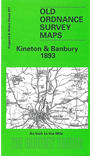
    This Inch to the Mile map covers much of southern Warwickshire with portions of Oxfordshire and Northants thrown in. Banbury is the largest place on the map, and other towns are Kineton and, in the SW corner, Shipston on Stour, in a detached portion of Worcestershire. Coverage stretches from Shipston and Hampton Lucy eastward to Byfield, and from Priors Marston southward to Banbury. The long closed East & West Junction Railway runs across the map and other features include numerous 'stately homes': Compton Wynyates, Charlecote Park, Compton Verney, Radway Grange and others. On the reverse we include an extract from Warwickshire Sheet 45.16 showing the centre of Kineton in detail, together with a directory.


    It is not possible to list the many hamlets, farmsteads and other topographical features shown on these maps. However, you may find it useful if we list the towns and principal villages or church parishes that are included on this map. Links are given for those for which detailed large-scale maps are also available.

  • Northamptonshire: Appletree, Aston le Walls, Byfield, Chalcombe, Charwelton, Chipping Warden, Lower Bodington, Middleton Cheney, Thenford, Thorpe Mandeville, Upper Bodington, Warkworth.
  • Oxfordshire: Alkerton, Banbury, Claydon, Cropredy, Drayton, Epwell, Great Boureton, Hanwell, Horley, Hornton, Mollington, Neithrop, North Newington, Shutford, Wardington, Wroxton.
  • Warwickshire: Avon Dassett, Barcheston, Bishops Itchington, Burton Dassett, Butlers Marston, Chadshunt, Charlecote, Chesterton, Compton Wyniates, Cornbrook, Eatington, Farnborough, Fenny Copmpton, Gaydon, Halford, Hampton Lucy, Honington, Idlicote, Kineton, Lighthorne, Lower Brailes, Loxley, Middle Tysoe, Moreton Morrell, Newbold Pacey, Oxhill, Pillerston Hersey, Pillerston Priors, Priors Hardwick, Priors Marston, Radway, Ratley, Shotteswell, Warmington, Wellesbourne Hastings, Wellesbourne Mountford, Whatcote, Wormleighton.
  • Worcestershire: Shipston on Stour, Tredington.

    For a full list of maps for the counties go to the Northamptonshire, Oxfordshire or Warwickshire pages.

    You can order maps direct from our On-line Mapshop. For other information and prices, and other areas, go to The Index Page.


    The Godfrey Edition / godfreyedition@btinternet.com / 23 January 2006