
 Here is information about Sheet 190:
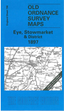
This One Inch to the Mile map covers the area around Stowmarket and Eye, most of it in East Suffolk. Coverage stretches from Emswell eastward to Brundish and Kettleburgh, and from Botesdale southward to Helmingham. The boundary between East and West Suffolk - a division going back to the Middle Ages, when the western part was held by Bury Abbey and part of SE Suffolk (the Liberty of St Etheldreda) by Ely Abbey - can be seen going through the map, along Hundred Lane. (Interestingly the OS does not note this 'border' though it does give the Isle of Ely and Stoke of Peterborough county status.) Features on the map include very small towns such as Debenham, Haughley, Eye and Botesdale (at the top edge); the Mellis & Eye railway; many windmills, though these were fast disappearing; halls and moats. On the reverse we include a detailed map for the centre of Eye, complete with directory and a timetable for the railway branch.
It is not possible to list the many hamlets, farmsteads and other topographical features shown on these maps. However, you might find it useful if we here list the majority of the principal villages and church parishes that are included on this map. Links are given for those for which detailed large-scale maps are also available.
Index maps are available showing the areas covered by the Inch to the Mile maps. Go to This page
You can order maps direct from our On-line Mapshop. For a full list of Inch to the Mile maps go to the Inch to the Mile page, where you will also find details of prices. For information on the rest of the series, go to The Index Page.