
Old Ordnance Survey Inch to the Mile Maps
These maps normally cover an area of about 18 miles by 12 miles and are especially good at showing railways, roads and canals, and at giving
a broad view of a wider area. Each includes an introduction and a more detailed map of a small town or village.
They are available through our On-line Mapshop
 Here is information about Sheet 184:
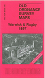
One Inch Sheet 184 Warwick & Rugby 1897 - published 2007; intro by Barrie Trinder. ISBN.978-1-84784-080-6 
This One Inch to the Mile map is taken from the early Coloured Edition. It covers the area from Warwick and Leamington eastward to Rugby, and from
Kings Newnham southward to Ladbroke. The maps are especially useful for those following the railways, and this includes the long
closed Leamington-Rugby line, part of the Weedon branch and a stretch of the GCR line from Rugby southward. Other features include the Warwick &
Napton Canal, Kenilworth, Southam. The map covers a good area of central east Warwickshire, with just fragments of Northants at the eastern edge.
On the reverse we include a detailed map of the small town of Southam.
It is not possible to list the many hamlets, farmsteads and other topographical features shown on these maps. However, you may find it useful if we list the towns and
principal villages or church parishes that are included on this map. Links are given for those for which detailed large-scale maps are also available.
Northamptonshire: Catesby.
Warwickshire: Ashow, Baginton, Barford, Bilton, Birdingbury, Bishops Tachbrook, Bourton on Dunsmore, Brandon and Bretford, Brownsover, Bubbenhall, Budbrooke, Church Lawford,
Clifton upon Dunsmore, Cubbington, Dunchurch, Eathorpe, Frankton, Grandborough, Harbury, Helidon, Hillmorton, Hunningham, Kenilworth, Kings Newnham, Ladbroke, Leamington, Leamington Hastings, Leek Wootton, Lillington,
Little Lawford, Long Itchington, Long Lawford, Lower Shuckburgh, Marton, Napton on the Hill, New Milverton, Newbold on Avon, Offchurch, Old Milverton, Princethorpe, Radford Semele, Rugby,
Ryton on Dunsmore, Sherborne, Southam, Stiviehall, Stockton, Stoneleigh, Stretton on Dunsmore, Thurlaston, Ufton, Upper Shuckburgh, Wappenbury, Warwick, Wasperton, Weston under Wetherley, Whitnash, Willenhall, Willoughby, Wolfhamcote, Wolston.
Index maps are available showing the areas covered by the Inch to the Mile maps. Go to This page
You can order maps direct from our On-line Mapshop. For a full list of Inch to the Mile maps go to the Inch to the Mile page,
where you will also find details of prices. For information on the rest of the series, go to The Index Page.
Alan Godfrey Maps, Prospect Business Park, Leadgate, Consett, Co Durham, DH8 7PW / sales@alangodfreymaps.co.uk / 16 April 2011