Old Ordnance Survey One-Inch Maps


These maps are taken from the famous OS "Inch to the Mile" Maps. Though obviously far less detailed than the large scale maps for which we are perhaps better known, they provide an invaluable overview of a wider area, typically 18 miles across by 12 miles down. For transport historians they are invaluable for showing old railways, while all historians need them for their close depiction of topography, including parish boundaries. These maps also mean that we can offer historical coverage for small villages where a large scale map would not be commercially viable. We intend to publish the whole of England and Wales in this series. Almost 200 titles are now available and we aim to publish three new titles each month. The maps include historical notes and all (except the double-sided Tyneside title) also include a large scale map of a small town or village in the area.

The maps are neatly folded and each includes a specially written introduction to the area. Maps can be purchased on our On-line Mapshop where further information about titles is given. Visit the One Inch Page for a full list of Inch to the Mile Maps, or The Index Page for a full list to the series and details of Prices.

Here is information about Sheet 177 & 194:

  • One Inch Sheet 177/194 Aberporth, Llangranog & District 1909 - published 2005; introduction by Alan Leather

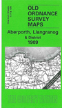
    These One Inch to the Mile maps, which we include together, cover much of SW Cardiganshire. Coverage stretches from Aberayron southward to Cenarth (and just north of Newcastle Emlyn), and from Llechryd eastward to Dilhewid and Ciliau-Aeron. There is a good section of the Cardigan coast, including New Quay, and on the back we include more detailed maps of two small Ports: Llangranog and Aberporth in 1904.


    It is not possible to list the many hamlets, farmsteads and other topographical features shown on these maps. However, you might find it useful if we here list the majority of the principal villages and church parishes that are included on this map. Links are given for those for which detailed large-scale maps are also available.

  • Cardiganshire: Aberaeron or Aberayron, Aberporth, Blaenporth, Ciliau-Aeron, Dilhewid, Henfynw Upper, Llanarth, Llanbadarn-Trefeglwys, Llanddewi Aberarth Upper, Llandyfriog, Llandygywydd, Llandyssiliogogo, Llanerch-Aeron, Llanfair-Oellwyn, Llangranog, Llangynilo, Llechryd, New Quay, Penbryn, Tremain, Troedyraur.
  • Carmarthenshire: Cenarth, Llanllwni.
  • Pembrokeshire: Manordeifi.

    For a full list of Inch to the Mile maps go to the One Inch Page, or for a full list of local maps go to Cardiganshire or Wales pages. For other information and prices, and other areas, go to The Index Page.


    The Godfrey Edition / godfreyedition@btinternet.com / 1 July 2006