
 Here is information about Sheet 150:
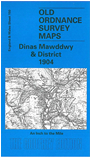
This Inch to the Mile map covers a large area of Montgomeryshire, with a smaller section of Merioneth in the NW corner. Coverage stretches from Cemmaes Road station eastward to Llanwyddelan, and from Dinas Mawddwy and Craig Dunant southward to Talerddig and Newydd Fynyddog. Features include stretches of the Cambrian Railway and the Mawddwy Railway, but the map is dominated by hilly terrain and ranges of the Cambrian Mountains. On the reverse we include a detailed map of the centre of Dinas Mawddwy.
It is not possible to list the many hamlets, farmsteads and other topographical features shown on these maps. However, you may find it useful if we list the towns and principal villages or church parishes that are included on this map. Links are given for those for which detailed large-scale maps are also available.
Index maps are available showing the areas covered by the Inch to the Mile maps. Go to This page
You can order maps direct from our On-line Mapshop. For a full list of Inch to the Mile maps go to the Inch to the Mile page, where you will also find details of prices. For information on the rest of the series, go to The Index Page.