Old Ordnance Survey One-Inch Maps


These maps are taken from the famous OS "Inch to the Mile" Maps. Though obviously far less detailed than the large scale maps for which we are perhaps better known, they provide an invaluable overview of a wider area, typically 18 miles across by 12 miles down. For transport historians they are invaluable for showing old railways, while all historians need them for their close depiction of topography, including parish boundaries. These maps also mean that we can offer historical coverage for small villages where a large scale map would not be commercially viable. We intend to publish the whole of England and Wales in this series. Over 200 titles are now available and we aim to publish three new titles each month. The maps include historical notes and all (except the double-sided Tyneside title) also include a large scale map of a small town or village in the area.

The maps are neatly folded and each includes a specially written introduction to the area. Maps can be purchased on our On-line Mapshop where further information about titles is given. Visit the One Inch Page for a full list of Inch to the Mile Maps, or The Index Page for a full list to the series and details of Prices.

Here is information about Sheet 145:

  • One Inch Sheet 145 King's Lynn & District 1907 - published 2007; introduction by Robert Malster

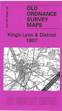
    This One Inch to the Mile map covers the area around King's Lynn, including the southern part of The Wash. Coverage stretches from Long Sutton eastward to Sandringham, and from Snettisham station southward to North Runcton. Features include the River Nene, River Ouse, channels through The Wash, Sandringham House, several long closed railways incl Great Northern Joint Railway and Lynn & Hunstanton, Sutton Bridge. We include a map of Castle Rising on the reverse.


    It is not possible to list the many hamlets, farmsteads and other topographical features shown on these maps. However, you might find it useful if we here list the majority of the principal villages and church parishes that are included on this map. Links are given for those for which detailed large-scale maps are also available.

  • Cambridgeshire: Tydd St Giles.
  • Lincolnshire: Long Sutton, Lutton, Sutton Bridge, Sutton t Mary, Tydd St Mary.
  • Norfolk: Castle Rising, Clenchwarton, Dersingham, East Winch, Gaywood, Ingoldisthorpe, King's Lynn, Middleton, North Runcton, Sandringham, South Wootton, Terrington, Terrington St Clement, Tilney All Saints, Tilney cum Islington, Walpole St Andrew, Walpole St Peter, West Lynn, West Newton, West Winch, Wolferton

    For a full list of Inch to the Mile maps go to the One Inch Page, or for a full list of Lincolnshire maps go to Lincolnshire page, or for Norfolk to go the Norfolk page. For other information and prices, and other areas, go to The Index Page.


    The Godfrey Edition / godfreyedition@btinternet.com / 22 June 2007