
 Here is information about Sheet 144:
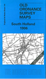
This One Inch to the Mile map covers the Lincolnshire fens around Spalding, which is near the centre of the map. Westward coverage goes as far as the South Four Foot Drain and a little beyond - there are no villages here, just the Hacconby Fen, Morton Fen, Aslackby Fen etc - while eastward it goes to Gedney; coverage continues northward to Fosdyke, southward to Deeping St Nicholas. The Midland & Great Northern Joint Railway crosses the map, with stations in extraordinarily remote places. The only towns are Spalding and Holbeach, and on the reverse we include a detailed map of the centre of Holbeach, with a brief directory.
It is not possible to list the many hamlets, farmsteads and other topographical features shown on these maps. However, you might find it useful if we here list the majority of the principal villages and church parishes that are included on this map. Links are given for those for which detailed large-scale maps are also available.
Index maps are available showing the areas covered by the Inch to the Mile maps. Go to This page
You can order maps direct from our On-line Mapshop. For a full list of Inch to the Mile maps go to the Inch to the Mile page, where you will also find details of prices. For information on the rest of the series, go to The Index Page.