
Old Ordnance Survey Inch to the Mile Maps
These maps normally cover an area of about 18 miles by 12 miles and are especially good at showing railways, roads and canals, and at giving
a broad view of a wider area. Each includes an introduction and a more detailed map of a small town or village.
They are available through our On-line Mapshop
 Here is information about Sheet 140:
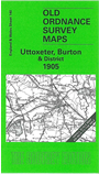
One Inch Sheet 140 Uttoxeter, Burton & District 1905 - published 2004; intro by Malcolm Nixon. ISBN.978-1-84151-620-2
This One Inch to the Mile map covers a broad stretch of east Staffordshire, with a smaller section of Derbyshire to the east. Coverage stretches from
Weston upon Trent eastward to Burton, and from Uttoxeter southward to Rugeley. On the reverse we include an extract from Staffs Sheet 38.01 showing the village of Weston upon Trent in detail, including both stations (one was called Ingestre).
A directory of Weston is also included.
It is not possible to list the many hamlets, farmsteads and other topographical features shown on these maps. However, you might find it useful if we here list the majority of the principal villages
and church parishes that are included on this map. Links are given for those for which detailed large-scale maps are also available.
Derbyshire: Barton Blount, Church broughton, Doveridge, Hatton, Hilton, Marston on Dove. Rosliston, Somershall Herbert, Sudbury, Sutton on the Hill, Walton upon Trent.
Staffordshire: Barton under Needwood, Bramshall, Branston, Brocton, Burton upon Trent, Colton, Colwich, Draycott in the Clay, Dunstall, Fradswell, Gayton,
Gratwich, Hamstall Ridware, Hanbury, Ingestre, Kings Bromley, Kingston, Marchington, Marchington Woodlands, Mavesyn Ridware, Milwich, Newborough, Pipe Ridware, Rugeley, Stowe,
Tatenhill, Tixall, Tutbury, Uttoxeter, Weston upon Trent, Yoxall.
Index maps are available showing the areas covered by the Inch to the Mile maps. Go to This page
You can order maps direct from our On-line Mapshop. For a full list of Inch to the Mile maps go to the Inch to the Mile page,
where you will also find details of prices. For information on the rest of the series, go to The Index Page.
Alan Godfrey Maps, Prospect Business Park, Leadgate, Consett, Co Durham, DH8 7PW / sales@alangodfreymaps.co.uk / 16 April 2011