Old Ordnance Survey One-Inch Maps


These maps are taken from the famous OS "Inch to the Mile" Maps. Though obviously far less detailed than the large scale maps for which we are perhaps better known, they provide an invaluable overview of a wider area, typically 18 miles across by 12 miles down. For transport historians they are invaluable for showing old railways, while all historians need them for their close depiction of topography, including parish boundaries. These maps also mean that we can offer historical coverage for small villages where a large scale map would not be commercially viable. We intend to publish the whole of England and Wales in this series. Almost 200 titles are now available and we aim to publish three new titles each month. The maps include historical notes and all (except the double-sided Tyneside title) also include a large scale map of a small town or village in the area.

The maps are neatly folded and each includes a specially written introduction to the area. Maps can be purchased on our On-line Mapshop where further information about titles is given. Visit the One Inch Page for a full list of Inch to the Mile Maps, or The Index Page for a full list to the series and details of Prices.

Here is information about Sheet 120:

  • One Inch Sheet 120 Cerrigydrudion, Corwen & District 1904 - published 2002; introduction by Derrick Pratt

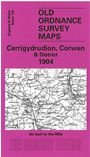
    This Inch to the Mile map covers Corwen and the area to the west, a region divided betwen Denbighshire and Merioneth. Apart from Corwen there are no towns and few sizeable villages. Author Derrick Partt tells us that it was an area that 19th century travellers "contemptuously dismissed" as "little more than huddles of poor houses beaded erratically along Telford's Holyhead Road". But there is always much of interest on a one-inch map, including here stretches of long lost railways, and the Alwen Valley which was soon to be flooded for a reservoir. Much of the land is mountain and moorland, with some of the Berwyn Mountains and the Denbigh Moors or Mynydd Hiraethog. On the reverse we include an extract from Merioneth sheet 15.15, showing Llandrillo in more detail, complete with directory.


    It is not possible to list the many hamlets, farmsteads and other topographical features shown on these maps. However, you may find it useful if we list the towns and principal villages or church parishes that are included on this map. Links are given for those for which detailed large-scale maps are also available.

  • Denbighshire: Cerrig-y-Druidion, Clocaenog, Llanfihangel Glyn Myfyr, Llangym, Pentre Foelas, Yspytty-ifan.
  • Merionethshire: Bettws-Gwerfil-Goch, Corwen, Gwyddelwern, Llandderfel, Llandrillo, Llangar.

    For a full list of maps for Denbighshire go to the Denbighshire page; for Merioneth go to the Merioneth page; or to the Wales page for a full list for the country.

    You can order maps direct from our On-line Mapshop. For other information and prices, and other areas, go to The Index Page.


    The Godfrey Edition / godfreyedition@btinternet.com / 24 November 2005