
Old Ordnance Survey Inch to the Mile Maps
These maps normally cover an area of about 18 miles by 12 miles and are especially good at showing railways, roads and canals, and at giving
a broad view of a wider area. Each includes an introduction and a more detailed map of a small town or village.
They are available through our On-line Mapshop
 Here is information about Sheet 63:
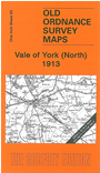
One Inch Sheet 63 Vale of York (North) 1913 - published 2007; intro by John Gough. ISBN.978-1-84151-997-5
This One Inch to the Mile map covers the area north of York. York itself is at the foot of the map and coverage extends north to Whenby, east to Millington. On the
reverse we include a detailed map of the village of Stamford Bridge, scene of the great battle between Harald Hardrada and King Harold. A directory of Stamford Bridge is also included. Features on the main map include
Castle Howard, the Derwent Valley Light Railway, York & Market Weighton branch, Forest of Galtres.
It is not possible to list the many hamlets, farmsteads and other topographical features shown on these maps. However, you may find it useful if we list the towns and
principal villages or church parishes that are included on this map. Links are given for those for which detailed large-scale maps are also available.
Yorkshire: Acklam with Barthorpe, Acomb, Barton le Willows, Birdsall, Bishop Wilton with Belthorpe, Bolton, Bossall with Buttercrambe, Bugthorpe, Buhner, Burythorpe,
Claxton, Crambe, Dunnington, Earswick, Eddlethorpe, Fangfoss, Farlington, Flaxton, Foston, Full Sutton, Gate Helmsley, Great Givendale, Harton, Haxby, High Catton, Howsham, Huby, Huntington, Huttons Ambo, Kennythorpe,
Kexby, Kirby Underdale, Kirkham, Knapton, Langton, Leavening, Leppington, Low Catton, Menethorpe, Millington, Nether Poppleton, North Grimston, Osbaldwick,
Rawcliffe, Sand Hutton, Scaryingham, Sheriff Hutton, Skelton, Skirpenbeck, Stamford Bridge, Stittenham,, Stillington, Stockton on the Forest, Strensall, Sutton on the Forest,
Thixendale, Thornton le Clay, Towthorpe, Upper Helmsley, Upper Poppleton, Welburn, Westow, Whenby, Whitwell on the Hill, Wigginton, Yapham cum Meltonby, York, Youlthorpe with Cowthorpe.
Index maps are available showing the areas covered by the Inch to the Mile maps. Go to This page
You can order maps direct from our On-line Mapshop. For a full list of Inch to the Mile maps go to the Inch to the Mile page,
where you will also find details of prices. For information on the rest of the series, go to The Index Page.
Alan Godfrey Maps, Prospect Business Park, Leadgate, Consett, Co Durham, DH8 7PW / sales@alangodfreymaps.co.uk / 16 April 2011