Old Ordnance Survey One-Inch Maps


These maps are taken from the famous OS "Inch to the Mile" Maps. Though obviously far less detailed than the large scale maps for which we are perhaps better known, they provide an invaluable overview of a wider area, typically 18 miles across by 12 miles down. For transport historians they are invaluable for showing old railways, while all historians need them for their close depiction of topography, including parish boundaries. These maps also mean that we can offer historical coverage for small villages where a large scale map would not be commercially viable. We intend to publish the whole of England and Wales in this series. Over 250 titles are now available and we aim to publish three new titles each month. The maps include historical notes and all (except the double-sided Tyneside title) also include a large scale map of a small town or village in the area.

The maps are neatly folded and each includes a specially written introduction to the area. Maps can be purchased on our On-line Mapshop where further information about titles is given. Visit the One Inch Page for a full list of Inch to the Mile Maps, or The Index Page for a full list to the series and details of Prices.

Here is information about Sheet 50:

  • One Inch Sheet 50 Dent, Ingleton & the Three Peaks 1904 - published 2010; introduction by Alan Godfrey

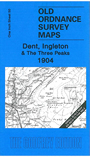
    This One Inch to the Mile map covers the area around the famous Three Peaks, Ingleborough, Penyghent (or Pen-y-Ghent) and Whernside, with coverage stretching from Ingleton eastward to Kelltlewell, and northward to Dwent and Hawes. It includes a major stretch of the Settle & Carlisle railway, plus the long closed line through Ingleton.


    It is not possible to list the many hamlets, farmsteads and other topographical features shown on these maps. However, you may find it useful if we list the towns and principal villages or church parishes that are included on this map. Links are given for those for which detailed large-scale maps are also available.

  • Yorkshire: Arncliffe, Bainbridge, Buckden, Dent, Gawthrop, Halton Gill, Hawes, Horton in Ribblesdale, Hubbersholme, Ingleton, Kettlewell, Litton, Ribblehead, Starbotton, Thornton Rust, Langstrothdale Chase.

    You can order maps direct from our On-line Mapshop. For other information and prices, and other areas, go to The Index Page.


    The Godfrey Edition / godfreyedition@btinternet.com / 24 May 2010