
 Here is information about Sheet 43:
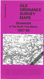
This One Inch to the Mile map covers a major part of the North York Moors, with coverage stretching from Egton, Castleton and Grosmont southward to Lastingham and Levisham. Several of the dales are covered: Rosedale, Farndale, Bransdale, Bilsdale. On the reverse we include a detailed map of the village of Grosmont in 1910.
It is not possible to list the many hamlets, farmsteads and other topographical features shown on these maps. However, you may find it useful if we list the towns and principal villages or church parishes that are included on this map. Links are given for those for which detailed large-scale maps are also available.
Index maps are available showing the areas covered by the Inch to the Mile maps. Go to This page
You can order maps direct from our On-line Mapshop. For a full list of Inch to the Mile maps go to the Inch to the Mile page, where you will also find details of prices. For information on the rest of the series, go to The Index Page.