Old Ordnance Survey One-Inch Maps


These maps are taken from the famous OS "Inch to the Mile" Maps. Though obviously far less detailed than the large scale maps for which we are perhaps better known, they provide an invaluable overview of a wider area, typically 18 miles across by 12 miles down. For transport historians they are invaluable for showing old railways, while all historians need them for their close depiction of topography, including parish boundaries. These maps also mean that we can offer historical coverage for small villages where a large scale map would not be commercially viable. We intend to publish the whole of England and Wales in this series. Over 200 titles are now available and we aim to publish three new titles each month. The maps include historical notes and all (except the double-sided Tyneside title) also include a large scale map of a small town or village in the area.

The maps are neatly folded and each includes a specially written introduction to the area. Maps can be purchased on our On-line Mapshop where further information about titles is given. Visit the One Inch Page for a full list of Inch to the Mile Maps, or The Index Page for a full list to the series and details of Prices.

Here is information about Sheet 42:

  • One Inch Sheet 42 Northallerton & the Cleveland Hills 1904 - published 2002; introduction by Trevor Pearson

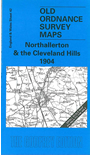
    This One Inch to the Mile map covers an area, as described by Trevor Pearson, "of Yorkshire's northern border, from the farmlands of the Vale of York across to the remote moor tops of the Cleveland Hills". Coverage stretches from Northallerton northward to Crathorne, and from Kirkby Hall eastward to Snilesworth Moor and The Cleveland Hills. On the reverse is a detailed map of Stokesley, with its Low Green, Market Place and High Green, and including the Manor House, Town Hall and Workhouse. A short commercial directory for Stokesley is also included. At the top of the One Inch map a tiny fragment of County Durham intrudes.


    It is not possible to list the many hamlets, farmsteads and other topographical features shown on these maps. However, you may find it useful if we list the towns and principal villages or church parishes that are included on this map. Links are given for those for which detailed large-scale maps are also available.

  • Co Durham: Sockburn.
  • Yorkshire North Riding: Ainderby Steeple, Appleton Wiske, Birkby, Brompton, Broughton, Carlton, Cowesby, Crathorne, Crosby, Dalton upon Tees, Danby Wiske, Deighton, East Cowton, East Harlsey, East Rounton, Ellerbeck, Eryholme, Faceby, Girsby, Great Busby, Great Langton, Great Smeaton, Hornby, Hutton Bonville, Hutton Rudby, Ingleby Arncliffe, Kiplin, Kirby Sigston, Kirkby, Kirkby Fleetham, Little Langton, Little Smeaton, Morton upon Swale, Nether Silton, North Cowton, Northallerton, Osmotherley, Over Silton, Picton, Potto, Romanby, Rudby, Scruton, Sexhow, South Cowton, Stokesley, Thimbleby, Thornton le Beans, Thrintoft, Warlaby, Welbury, West Harlsey, West Rounton, Whitwell, Whorlton, Yafforth.

    For a full list of maps for the county go to the Westmorland page; or to the Cumbria page for a full list for Cumbria.

    You can order maps direct from our On-line Mapshop. For other information and prices, and other areas, go to The Index Page.


    The Godfrey Edition / godfreyedition@btinternet.com / 13 May 2007