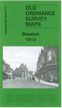
Notts Sheet 41.12 Beeston 1913 - published 2011; intro by Barrie Trinder. ISBN.978-1-84784-535-1 
This very detailed map covers the town of Beeston, SW of Nottingham.
Features include town centre with individual buildings neatly shown, St John's church, Anglo-Scotian Mills, lace factories,
iron foundry, small portion of railway but not station, schools, Beeston Fields etc. On the reverse we include a selection of trade directory entries from Wright's 1902 directory.
Follow this link for a complete list of our Nottinghamshire Series maps.
You can order maps direct from our On-line Mapshop.
For other information and prices, and other areas, go to The Index Page.
Maps in the Godfrey Edition are taken from the 25 inch to the mile map and reduced to about 15 inches to the mile.
For a full list of maps for the East Midlands, return to the East Midlands page.
The Godfrey Edition / sales@alangodfreymaps.co.uk / 28 January 2018

 Here are the details of maps for Beeston: