
 Here are the details of maps for Gorleston:

We have published a set of four detailed maps for Yarmouth and Gorleston. They link up with each other to provide good coverage. This map covers most of Gorleston, with coverage stretching from School Lane southward to Clarence Road. Features include North and South Pier, Cliff Hotel, Gorleston station, Gorleston Cemetery, The Point, tramways and depot, St Andrew's church, graving dock, lifeboat stations, Gorleston House etc.A directory of Gorleston is included on the reverse.
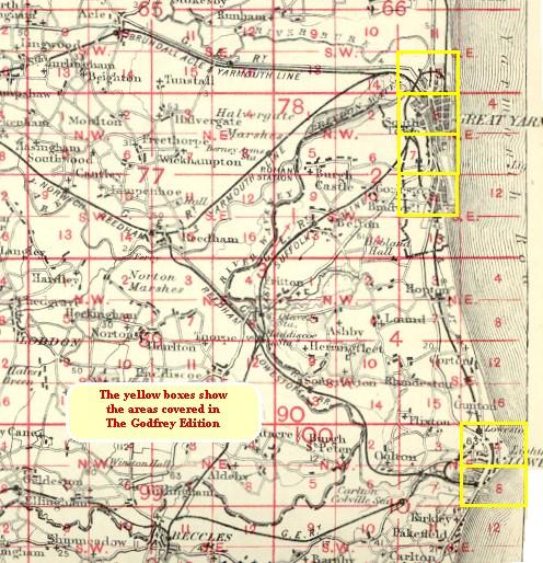
The map links up with Norfolk Sheet 78.07 Yarmouth South to the north.
You might find this index map useful.