Old Ordnance Survey Maps of Norfolk

  • These detailed maps normally cover an area of about one and a half miles by one mile. Each map includes an introduction.
  • They are available through our On-line Mapshop

  • Here are the details of maps for Swaffham:

  • Norfolk Sheet 59.06 Swaffham 1926 - published 2006; intro by Robert Malster. ISBN.978-1-84151-964-7

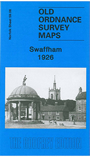
    This detailed map is double-sided to give maximum coverage of Swaffham, once known as "The Montpelier of England" and one of Norfolk's most fashionable centres in the 18th century. The Assembly Rooms in the Market Place, built in 1817, reflect this. Most of the town is covered on this map and features include The Shambles, St Peter & St Paul church, Market Place, London Street, Manor House, Rookery Farm, Ash Close, Lynn Street, railway and station, Tumbler Hill, Dovehouse Row, cemetery, Shire Hall, Wood Farm. A list of private residents from a 1929 directory is included.


  • Follow this link for a complete list of our Norfolk or Suffolk map; or for a full list of maps for East Anglia, go to the East Anglia page.
  • Most maps in the Godfrey Edition are taken from the 25 inch to the mile map and reduced to about 15 inches to the mile. You can order maps direct from our On-line Mapshop. For other information and Prices, see Index Page.
    The Godfrey Edition / sales@alangodfreymaps.co.uk / 28 January 2018