
 Here are the details of maps for North Walsham:

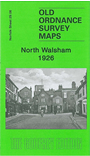
This detailed map is double-sided to give maximum coverage of North Walsham. The main map covers the eastern part of the town, from Church Street eastward to Edingthorpe Heath, and from Lingate Road southward to White Horse Road. Features here include the area known as New Town, Bluebell Common, cemetery, Brunswick House, Spa Common, the North Walksham & Dilham Canal, Bacton Wood Mill. On the reverse is a large portion of adjacent sheet 29.05 and this covers the town centre, including Market Place, St Nicholas church, Nelson Street, Grammar School Road, and areas westward to Cherrytree Lane and Skeyton Road. Major features here include the two railway stations.