We have published more than 2,000 maps in our series of Old Ordnance Survey Map reprints, including a growing title range in East Anglia. The maps are highly detailed. They are taken from the OS 1:2,500 (or 25 inch) maps and reduced to about 15 inches to the mile. Each covers an area of a mile and a half by a mile. They show streets with individual houses, tram tracks, railway tracks and even signals, factories, wharves and such details as fountains and water troughs. They will provide hours of fascination for historians and genealogists. The maps are neatly folded and each includes a specially written introduction to the area. Maps can be purchased on our On-line Mapshop where further information about titles is given. Or visit The Index Page for a full list to the series and details of Prices.
Here are the details of maps for Cromer:
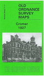
This detailed map is double-sided for maximum coverage. The main map covers the centre of the town and the area southward to Brown's Hill and Suffield Park. The LNER Cromer station is near the foot of the map. Features include Beach station, Howard's Hill, St Peter & St Paul church, Town Hall, The Meadow, Cromer Hall, Hall Wood, New Haven Court Hotel, Royal Links Hotel. On the reverse we include adjacent sheet 11.07 which has the seafront, including the Pier, Grand Hotel, Marlborough House Hotel.
Follow this link for a complete list of our Norfolk Series maps.
You can order maps direct from our On-line Mapshop. For other information and prices, and other areas, go to The Index Page.
Maps in the Godfrey Edition are taken from the 25 inch to the mile map and reduced to about 15 inches to the mile. For a full list of maps for East Anglia, return to the East Anglia page.
The Godfrey Edition / For queries email sales@alangodfreymaps.co.uk / 28 Sept 2007