Old Ordnance Survey Maps of Norfolk

  • These detailed maps normally cover an area of about one and a half miles by one mile. Each map includes an introduction.
  • They are available through our On-line Mapshop

  • Here are the details of maps for Sheringham:

  • Norfolk Sheet 10.08 Sheringham (West) 1926 - published 2007; introduction by Alan Crosby

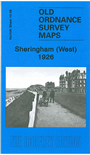
    This detailed map covers the western half of Sheringham, on the north Norfolk coast. Features on the map include St Peter's church, Church Street, station, The Boulevard, Burlington Hotel, Grand Hotel, Skelding Hill, Holt Road, golf links, Franklin Hill. Open country is reached beyond Holt Road but Mace Hill and a small portion of Sheringham Park (incl The Old House) are in the SW corner. A list of private residents from a 1929 directory is included on the reverse.


    The map links up with Sheringham East to the east.


    Follow this link for a complete list of our Norfolk Series maps.

    You can order maps direct from our On-line Mapshop. For other information and prices, and other areas, go to The Index Page.


    Maps in the Godfrey Edition are taken from the 25 inch to the mile map and reduced to about 15 inches to the mile. For a full list of maps for East Anglia, return to the East Anglia page.

    The Godfrey Edition / godfreyedition@btinternet.com / 19 Dec 2010