Old Ordnance Survey Maps of Blyth


We have published more than 2,000 maps in our series of Old Ordnance Survey Map reprints, including several titles in Northumberland. The maps are highly detailed. They are taken from the OS 1:2,500 (or 25 inch) maps and reduced to about 15 inches to the mile. Each covers an area of a mile and a half by a mile. They show streets with individual houses, tram tracks, railway tracks and even signals, factories, wharves and such details as fountains and water troughs. They will provide hours of fascination for historians and genealogists. The maps are neatly folded and each includes a specially written introduction to the area. Maps can be purchased on our On-line Mapshop where further information about titles is given. Or visit The Index Page for a full list to the series and details of Prices.


Here are the details of maps for Blyth:

  • Northumberland Sheet 73.10 Blyth 1897 - published 1992; introduction by Iain Watson

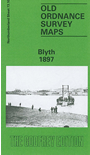
    This detailed map covers the town of Blyth, including the port. Most of the town is shown, including Crofton, Waterloo, Cowpen, Cowpen Quay and North Blyth. Features include the station, Market Place, staiths at North Blyth, NER New Blyth line along the Low Quay, Cowpen Colliery Mill Pit, Cowpen Colliery A Pit, Cowpen Colliery North Pit (disused) with railway, Blyth High Ferry, Crofton Mills, bottle works, East Pier, rope works. A list of private residents from an early directory is included.

    Follow this link for a complete list of our Northumberland maps.

    You can order maps direct from our On-line Mapshop. For other information and prices, and other areas, go to The Index Page.


    Maps in the Godfrey Edition are taken from the 25 inch to the mile map and reduced to about 15 inches to the mile. For a full list of maps for the North East, return to the North East page.

    The Godfrey Edition / godfreyedition@btinternet.com / 24 October 2007