
 Here are the details of maps for Ashington:

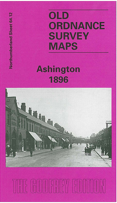
This remarkable and highly detailed map shows the mining village of Ashington, considered a model pit village when founded in the 1860s. Ashington Colliery is in the centre of the map and and below this are the neat rows of terraces, named 'First Row' up to 'Ninth Row'. These all faced south and had long gardens. South of these are St Sepulchre's church, Portland Arms Hotel, Miners Hall and Market Place (effectively a street). To the east is the NER line with Ashington station, and beyond this the map covers part of New Hirst. However, the notable feature of this map is the tramway system, a network of track which was ultimately around ten miles long which served virtually every street and house, horse drawn trucks delivering coal and collecting refuse and night soil. These tracks are shown here in detail, both in Ashington and New Hirst. On the reverse we include part of sheet 65.09, extending coverage eastward to Woodhorn Colliery.