Old Ordnance Survey Maps of Merionethshire
These detailed maps normally cover an area of about one and a half miles by one mile. Each map includes an introduction.
They are available through our On-line Mapshop
 Here are the details of maps for Barmouth:
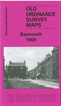
Merionethshire Sheet 36.06 Barmouth - published 2004; intro by Alan Leather. ISBN.978-1-84151-644-8 
This detailed map covers the coastal town of Barmouth in 1900. Points of interest on the map include St Margarets School, St Tudwals RC Church, Orielton
Hall and St Johns Church. Other features include Orielton Wood, Barmouth Bridge, Aber-Amffra Harbour and the Cambrian Railway which travels along
the coastline. On the reverse of the map we have an area to the north of Barmouth which includes Parsel and a historical introduction by Alan Leather.
Follow this link for a complete list of our Merionethshire Series maps.
You can order maps direct from our On-line Mapshop.
For other information and prices, and other areas, go to The Index Page.
Maps in the Godfrey Edition are taken from the 25 inch to the mile map and reduced to about 15 inches to the mile.
For a full list of maps for Wales, return to the Wales page.
The Godfrey Edition / sales@alangodfreymaps.co.uk / 31 March 2018