We have published more than 2,000 maps in our series of Old Ordnance Survey Map reprints, including a group for the Merionethshire area. The maps are highly detailed. They are taken from the OS 1:2,500 (or 25 inch) maps and reduced to about 15 inches to the mile. Each covers an area of a mile and a half by a mile. They show streets with individual houses, tram tracks, railway tracks and even signals, factories, wharves and such details as fountains and water troughs. They will provide hours of fascination for historians and genealogists. The maps are neatly folded and each includes a specially written introduction to the area.
Maps can be purchased on our On-line Mapshop where further information about titles is given. Or visit The Index Page for a full list to the series and details of Prices.
Here are the details of maps for Bala:
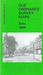
This detailed map covers Bala in 1899 with the village of Llanfor creeping in at the top right hand side of the map, and the Bala & Ffestiniog Railway running diagonally across the map between the two. The River Dee twists and turns alongside the railway line, the whole of the area around it being liable to floods. Other features include Christ Church, County School, Bala Union Workhouse, Victoria Hall and Bala Junction Station. On the back of the map, we have a historical introduction by Derrick Pratt and a directory.
Follow this link for a complete list of our Merionethshire Series maps.
You can order maps direct from our On-line Mapshop. For other information and prices, and other areas, go to The Index Page.
Maps in the Godfrey Edition are taken from the 25 inch to the mile map and reduced to about 15 inches to the mile. For a full list of maps for Wales, return to the Wales page.
The Godfrey Edition / godfreyedition@btinternet.com / 31 July 2007