Old Ordnance Survey Maps of Merionethshire
These detailed maps normally cover an area of about one and a half miles by one mile. Each map includes an introduction.
They are available through our On-line Mapshop
 Here are the details of maps for Corwen:
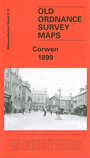
Merionethshire Sheet 08.13 Corwen 1899 - published 2002; intro by Derrick Pratt. ISBN.978-1-84151-406-2 
This map shows Corwen in 1899, with the railway line being a prominent feature through the map, the line being closed in 1962. Corwen boasted six
hotels which can be seen on the map, four of which are still running today. Three quarriess are visible to the south of the town, one of which is straight underneath the
Corwen Union Workhouse which served six parishes in Merionethshire and seven in Denbighshire. The river Dee runs around the town travelling from one end of the map to the other above the railway line.
The map also features an historical introduction by Derrick Pratt.
Follow this link for a complete list of our Merionethshire Series maps.
You can order maps direct from our On-line Mapshop.
For other information and prices, and other areas, go to The Index Page.
Maps in the Godfrey Edition are taken from the 25 inch to the mile map and reduced to about 15 inches to the mile.
For a full list of maps for Wales, return to the Wales page.
The Godfrey Edition / sales@alangodfreymaps.co.uk / 31 March 2018