
 Here are the details of the map for the Spitalfields area:

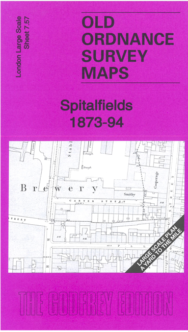
This very detailed map covers Spitalfields and part of Whitechapel. It is double-sided, with the 1873 map on one side and a reduced version of the 1894 map on the area. We also include an introduction to the history of the area.
Features (from 1871 map) include Commercial Street area, All Saints church, St Anne's RC Chapel, Whitechapel Society's School, East London Theatre, Trinity Chapel, Whitechapel Union Workhouse, Pavilion Theatre, Tower Hamlets Swimming Baths, Christ Church, St Stephen's church, St Mary's church, Catholic & Apostolic church, Black Eagle Brewery, schools, distilleries etc. Churches and some other public buildings have interiors mapped. The 1894 map includes Spitalfields Market.
The map links up with sheet 7.56 Finsbury Square to the west, 7.67 Aldgate to the south, 7.58 Whitechapel to the east.