We have published more than 2,000 maps in our series of Old Ordnance Survey Map reprints, with a highly successful series for London. Most maps are taken from the OS 1:2500 (or 25 inch) maps and reduced to about 15 inches to the mile. Each covers an area of a mile and a half by a mile. These show the areas in considerable detail, including individual houses.
For a few areas of central London we have also reprinted some of the very early Five-foot plans. Originally published at a scale of 1:1056 or 5 feet to the mile, we have reduced them in scale to 1:1760 or a Yard to the Mile. The maps, though covering quite a small area, are quite wonderfully detailed, showing such features as lamp-posts, the layouts of back yards, and even the interior of certain buildings such as churches and theatres. For the urban historian they are perhaps the most fascinating maps ever published by the Ordnance Survey.
Our reprints are neatly folded and each includes a specially written introduction to the area. Maps can be purchased on our On-line Mapshop where further information about titles is given. Or visit The Index Page for a full list to the series and details of Prices.
Here are the details of maps for Aldgate & Whitechapel:
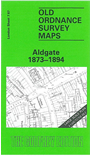
This highly detailed map at a 'Yard to the Mile' scale covers the western part of Whitechapel. Coverage stretches from Aldgate eastward to Gloucester Street and Christian Street, and from Cable Street northward to Goulston Street. Whitechapel High St, Commercial Road and Leman Street are the main thoroughfares. Features include LNWR Goods Depot, a stretch of the London & Blackwall Railway, Garrick Theatre, St Mark's church, German Chapel, St Botolph without Aldgate church, Leman Street station, Tobacco & Snuff Manufactory, Public Baths, St Mary Matfelon church, St Jude's church Commercial St. On the reverse we include a map of the same area in 1894, at a slightly reduced scale, now showing Aldgate station and the LTSR Goods Depot at Commercial Road and tramways. Lesley Underwood reminds us that this was 'one of the most cosmopolitan aereas of London' by the second half of the 19th century, with a population formed 'by an assortment of humanity drawn by the Docks and the City'.
The map links up with sheets 7.66 Bank to the west, 7.77 The Tower to the south.
Follow this link for a complete list of our London Series maps.
You can order maps direct from our On-line Mapshop. For other information and prices, and other areas, go to The Index Page.
Most maps in the Godfrey Edition are taken from the 25 inch to the mile map and reduced to about 15 inches to the mile. For a full list of maps for London, return to the London page.
The Godfrey Edition / godfreyedition@btinternet.com / 24 May 2007