Old Ordnance Survey Town Plans of London

  • These highly detailed maps, at a scale of 1:1760 or a Yard to the Mile, cover parts of central London in exceptional detail. They are available through our On-line Mapshop

  • Here are the details of the map for the Bricklayers Arms Station area:

  • London Large Scale Sheet 11.06 Bricklayers Arms Station 1871-93 - published 2023. Intro by Alan Godfrey. ISBN.978-1-78721-697-6

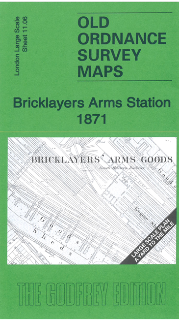
    This very detailed map covers Bricklayers Arms Station and the Locks Fields area to the west. The main map is the 1871 survey. A reduced version of the 1893 map is included on the reverse.

    Features include Bricklayers Arms station, incl engine sheds, goods sheds, stables, carriage shed; St Mary Magdalene Church, Deaf & Dumb Asylum, All Saints church, chapels, schools, much of East Street, Old Kent Road, etc

    The map links up with sheet 11.05 Newington Butts to the west.


  • For other Town Plans go to the London Town Plans page. Here is an Index Grid
  • For a full list of maps for London and Middlesex, return to the London page.
  • For other information and prices, and other areas, go to The Home Page.
  • Maps are available through our On-line Mapshop
    Alan Godfrey Maps, Prospect Business Park, Leadgate, Consett, DH8 7PW. Tel 01207 583388
    The Godfrey Edition / sales@alangodfreymaps.co.uk / 23 January 2024