We have published more than 2,000 maps in our series of Old Ordnance Survey Map reprints; this includes more than a hundred in Scotland, with a growing range of maps around Glasgow. The maps are highly detailed. They are taken from the OS 1:2,500 (or 25 inch) maps and reduced to about 15 inches to the mile. Each covers an area of a mile and a half by a mile. They show streets with individual houses, tram tracks, railway tracks and even signals, factories, wharves and such details as fountains and water troughs. They will provide hours of fascination for historians and genealogists. The maps are neatly folded and each includes a specially written introduction to the area. Maps can be purchased on our On-line Mapshop where further information about titles is given. Or visit The Index Page for a full list to the series and details of Prices.
Here are the details of maps for Hamilton:
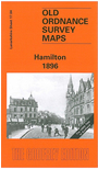
This detailed and busy map covers the heart of Hamilton, with the Town Hall and Central station near the centre of the map. Coverage stretches from Hamilton West station eastward to Covan Bridge. Features include Barncluth Colliery, Bent Colliery, Allanshaw Colliery, Bent Cemetery, Hamilton NBR station, Hamilton CR West and Central stations, Hamilton Palace, Great Avenue, Quarry Street, Eddlehurst, Union Street, Almada Street, Silverton Colliery. On the reverse are street directories for Almada Street, Cadzow Street, Portland Place, Quarry Street, Townhead Street.
You might find this index map useful. The map links up with Sheet 11.16 Hamilton Low Parks to the north.
Follow this link for a complete list of our Lanarkshire maps.
You can order maps direct from our On-line Mapshop. For other information and prices, and other areas, go to The Index Page.
Maps in the Godfrey Edition are taken from the 25 inch to the mile map and reduced to about 15 inches to the mile. For a full list of maps for Scotland, return to the Scotland page.
The Godfrey Edition / godfreyedition@btinternet.com / 31 December 2006