Old Ordnance Survey Maps of Motherwell (East)


We have published more than 2,000 maps in our series of Old Ordnance Survey Map reprints; this includes more than a hundred in Scotland, with a growing range of maps around Glasgow. The maps are highly detailed. They are taken from the OS 1:2,500 (or 25 inch) maps and reduced to about 15 inches to the mile. Each covers an area of a mile and a half by a mile. They show streets with individual houses, tram tracks, railway tracks and even signals, factories, wharves and such details as fountains and water troughs. They will provide hours of fascination for historians and genealogists. The maps are neatly folded and each includes a specially written introduction to the area. Maps can be purchased on our On-line Mapshop where further information about titles is given. Or visit The Index Page for a full list to the series and details of Prices.


Here are the details of maps for Motherwell (East):

  • Lanarkshire Sheet 12.14 Motherwell (East) 1897 - published 2006; introduction by Gilbert Bell

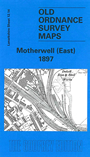
    We have published two maps of Motherwell, which link up to provide good coverage of the town. Each covers an area of a mile by a mile and a half. They are so detailed that individual houses and railway tracks are shown. This map covers the eastern part of the town, and extends coverage eastward to Middle Johnston colliery. Features include Windmillhill Street, Millar Street, Poorhouse, Dalzell Iron & Steel Works, Wagon Works, Knowetop, Craigeneuk, part of Rumblingsike, part of Flemington, Lanarkshire Steel Works, Dalzell Colliery Pit 2, Ravenscraig, Nether Johnston Colliery Pits 1 & 2, Carfin Colliery Pit 7, Middle Johnston Colliery Pit 10, Over Johnston Colliery Victoria Pit. Many railways are shown linking collieries and iron works. On the reverse we include extracts from Macdonalds Trade Directory 1896.


    You might find this index map useful. The map links up with Sheet 12.10 Carfin to the north, 12.13 Motherwell to the west.


    Follow this link for a complete list of our Lanarkshire maps.

    You can order maps direct from our On-line Mapshop. For other information and prices, and other areas, go to The Index Page.


    Maps in the Godfrey Edition are taken from the 25 inch to the mile map and reduced to about 15 inches to the mile. For a full list of maps for Scotland, return to the Scotland page.

    The Godfrey Edition / godfreyedition@btinternet.com / 17 July 2007